Overview |
 Comments (0) |
 Ratings (0) |
 Download |

|
||||||||||||||||||||
|
Search
Software
Advertisements!
Free-downloads
|
Options for Geodaten Deutschland
Advertisement
Geodaten Deutschland
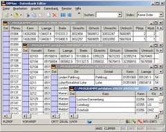
 Geodata of the Federal Republic Germany with municipalities, postal codes, telefone preselections. Suitable for branch searches, periphery searches and distance computations. Georeferences as Gauss Krueger, UTM and geographic coordinates. ORTREF: 12.500 geocoded cities and municipalities. ORTGEM: Allocation of 12.500 cities and municipalities to the localities. ORTTLREF: 63.000 geocoded local parts. ORTTLGEM: Allocation of 63.000 local parts to the localities. PLZREF: 32.000 geocoded postal zip codes of the zip areas and p.o. box areas. PLZGEM: Allocation of 32.000 postal zip codes to the localities. VORWREF: 14,500 geocoded telephone local area preselections. VORWGEM: Allocation of 14.500 local area preselections to the localities. KREIS: 450 Local districts. REGBEZ: Governmental districts. LAND: Counties of the German Federal Republic. The download contains a test composition of the data of 5 local districts, the exact data description and a conversion program for producing of different data formats. Here the data fields of the table ORTREF are specified as example: Place name, municipality key, geographical longitude and geographical latitude in degree notation, geographical longitude and geographical latitude in degree / minute / secund notation, Gauss Krueger easting, Gauss Krueger northing, UTM easting, UTM northing, new postal zip code (significant digits), old postal zip code, number of inhabitants, No. of the telephone directory, No. of the topographic card 1:25000, UNLOCODE, type of place.
Advertisement
|
|||||||||||||||||||